
Water levels and open ramps, free. Download the app for a depth map that shows you exactly where the water runs out — and keeps working where the signal doesn’t.
Get started for free today
Find your lake
No lakes match that yet.
The map
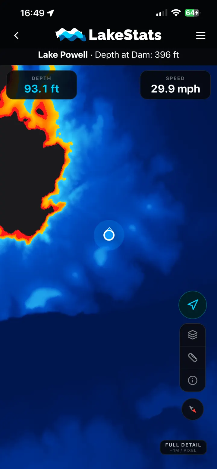
You don’t need a photorealistic lakebed while you’re at the wheel. You need to know where it’s deep, where it’s shallow, and how close the difference is. That’s the whole map.
What you get
The things people come for — how high is the lake, is my ramp open, how deep is it here — stay free. LakeStats Pro is what turns the map into a trip planner.
On the web
Free — no account, no download
In the app
Free with an account
Subscription
$39.99 a year
LakeStats Pro
The base map tells you where the water is. LakeStats Pro tells you what’s in it, what’s coming, and what other boaters found today.
Hundreds of them — beaches, coves, marinas, canyons and campsites, mapped and searchable. We're adding more every month.
Submerged rocks, debris and low-water surprises, flagged by the boaters who found them and dated so you know how fresh it is.
Where the markers are now — they move, and a chart printed last season doesn't know that.
The forecast for the lake's own coordinates, not the nearest town's: temperature, wind and gusts, rain chance, and the next seven days.
What the water is actually doing right now, reported by people who are on it.
Your speed over ground, live on the map, without a second device on the dash.
The depth beneath you as you move, updating as you go — read straight off the map.
$39.99 a year, billed through the App Store. Everything listed as free stays free.
Common questions
No. Levels, percent full, historical graphs and ramp status are on the website, free, with no account. The app is for the depth map — that has to live on your phone so it works offline.
That's the point of it. The app downloads a lake's map before you launch, so it keeps working in a canyon, twenty miles from a tower, with your phone in airplane mode.
The lakebed comes from depth surveys and the water level from the Bureau of Reclamation, so what you see is survey depth measured against today's surface. Sediment shifts, surveys age, and the shallow edges are always the least certain part. Treat it as a very good guide, not a guarantee — keep your eyes up.
Lake Powell, Bear Lake, Lake Tahoe, Lake Mead, Roosevelt Lake, Flaming Gorge, Deer Creek, Lake Mohave, Carter Lake, Horsetooth Reservoir, Fontenelle Reservoir, Strawberry Reservoir, East Canyon Reservoir, Jordanelle Reservoir, Pineview Reservoir, Starvation Reservoir, Echo Reservoir, Red Fleet Reservoir, Willard Bay, Causey Reservoir, Lake Pleasant and Lake Havasu — with more on the way. 8 of them have the depth map so far; the search above shows what's live right now.
$39.99 a year, billed through the App Store. Everything listed as free stays free.
Check the level from the driveway. Take the map out with you.